
How to get from Morgan's (airport) (Oregon) to Wilsonville (Oregon)
Calculate route from Morgan's (airport) (Oregon, United States) to Wilsonville (Oregon, United States).
The flight distance (as the crow flies) between Morgan's (airport) and Wilsonville is 50.6 km.
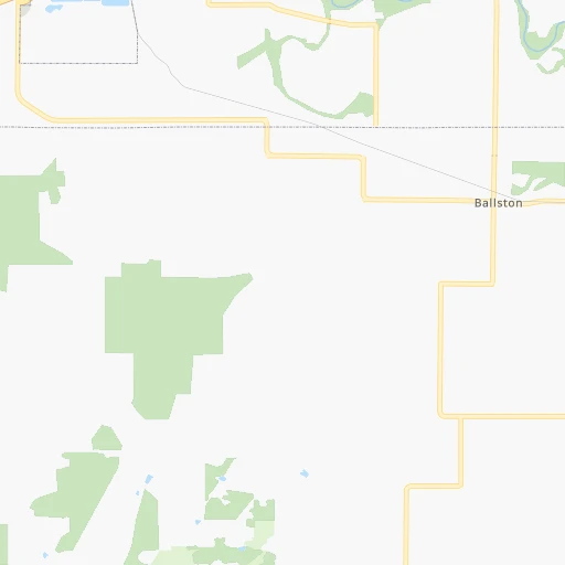
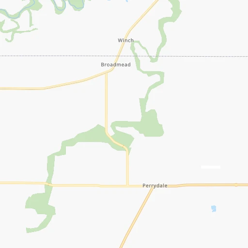
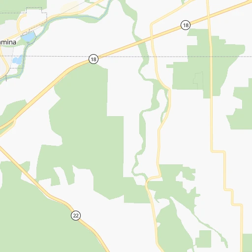
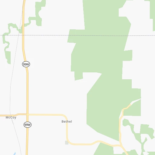
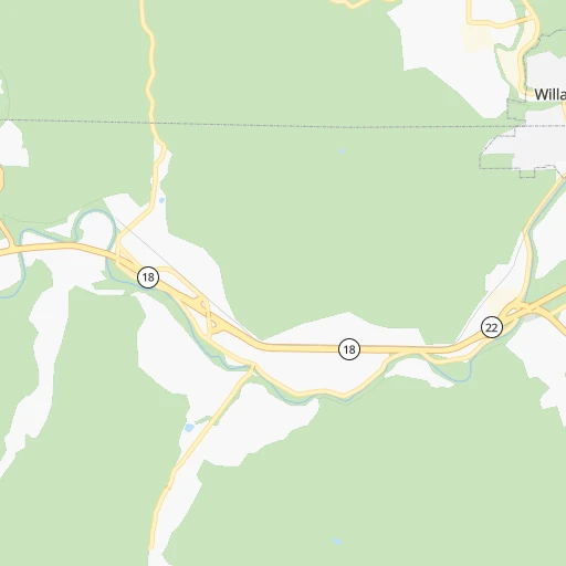
Roadmap (route) to go from Morgan's Airport to Wilsonville detailed above, you can also see the course layout on the map.
While doing trip Morgan's (airport) - Wilsonville by car, the calculated route ends at a distance , or more straight.
Distance and duration of the route between Morgan's (airport) and Wilsonville
Calculation of distance and route from Wilsonville to Morgan's (airport) :
50.665.4 km1h57mn
Continue 0h0mn 71 mTurn right onto Ballston Road 0h1mn 501 mTurn left onto Dejong Road 0h5mn 3.8 kmTurn left onto Southwest Christensen Road 0h1mn 1.2 kmTurn right onto Salmon River Highway 0h10mn 13.2 kmKeep right onto West McMinnville Bypass 0h15mn 19.2 kmTurn left onto Newberg-Dundee Bypass 0h5mn 6.7 kmTurn right onto Northeast Saint Paul Highway 0h1mn 717 mTurn left onto Northeast Wilsonville Road 0h17mn 18.0 kmTurn slight right onto Southwest Wilsonville Road 0h2mn 1.5 kmKeep right 0h1mn 360 mArrive at destination 0h0mn 0 m
Travel from Morgan's (airport) (Oregon) to a selection of major cities.
Distances from Morgan's Airport to biggest cities in Oregon
- West Linn,26,593 inhabitants.65 km
- Woodburn,25,173 inhabitants.38 km
- Forest Grove,23,897 inhabitants.53 km
- Newberg,22,780 inhabitants.38 km
- Wilsonville,22,729 inhabitants.51 km
- Roseburg,22,114 inhabitants.206 km
- Klamath Falls,21,399 inhabitants.340 km
- Ashland,20,861 inhabitants.324 km
- Milwaukie,20,830 inhabitants.69 km
- Bethany,20,646 inhabitants.66 km
- Lents,20,156 inhabitants.75 km
Other major cities in country :
- Charlotte [NC], 827,097 inhabitants. 3,730 km
- Seattle [WA], 684,451 inhabitants. 293 km
- Denver [CO], 682,545 inhabitants. 1,616 km
- El Paso [TX], 681,124 inhabitants. 2,078 km
- Detroit [MI], 677,116 inhabitants. 3,223 km
- Boston [MA], 667,137 inhabitants. 4,143 km
- Memphis [TN], 655,770 inhabitants. 3,015 km
- New South Memphis [TN], 641,608 inhabitants. 3,018 km
- Oklahoma City [OK], 631,346 inhabitants. 2,425 km
- Las Vegas [NV], 623,747 inhabitants. 1,206 km
- Baltimore [MD], 621,849 inhabitants. 3,852 km
- Washington, D.C. [DC], 601,723 inhabitants. 3,838 km
- Milwaukee [WI], 600,155 inhabitants. 2,820 km
- South Boston [MA], 571,281 inhabitants. 4,145 km
- Albuquerque [NM], 559,121 inhabitants. 1,797 km
- Tucson [AZ], 531,641 inhabitants. 1,786 km
- Nashville [TN], 530,852 inhabitants. 3,212 km
- Fresno [CA], 520,052 inhabitants. 973 km
- Sacramento [CA], 490,712 inhabitants. 738 km
- Kansas City [MO], 475,378 inhabitants. 2,452 km
Route from Wilsonville to major cities (United States).
- Distance Wilsonville New York City3,942 km
- Distance Wilsonville Los Angeles1,310 km
- Distance Wilsonville Chicago2,836 km
- Distance Wilsonville Brooklyn3,949 km
- Distance Wilsonville Houston2,950 km
- Distance Wilsonville Queens3,956 km
- Distance Wilsonville Philadelphia3,887 km
- Distance Wilsonville Phoenix1,606 km
- Distance Wilsonville Manhattan3,941 km
- Distance Wilsonville San Antonio2,762 km
- Distance Wilsonville San Diego1,482 km
- Distance Wilsonville The Bronx3,946 km
- Distance Wilsonville Dallas2,624 km
- Distance Wilsonville San Jose889 km
- Distance Wilsonville Austin2,746 km
- Distance Wilsonville Jacksonville3,927 km
- Distance Wilsonville San Francisco838 km
- Distance Wilsonville Columbus3,277 km
- Distance Wilsonville Fort Worth2,592 km
- Distance Wilsonville Indianapolis3,039 km
Nearest cities to Morgan's (airport) :
- Seattle, 684,451 inhabitants. 293 km
- Portland, 632,309 inhabitants. 72 km
- Tacoma, 207,948 inhabitants. 253 km
- Vancouver, 172,860 inhabitants. 82 km
- Salem, 164,549 inhabitants. 27 km
- Eugene, 163,460 inhabitants. 115 km
- Bellevue, 139,820 inhabitants. 296 km
- Kent, 126,952 inhabitants. 271 km
- Gresham, 110,553 inhabitants. 85 km
- Everett, 108,010 inhabitants. 336 km
- Hillsboro, 102,347 inhabitants. 57 km
- Renton, 100,242 inhabitants. 282 km
- Beaverton, 96,577 inhabitants. 62 km
- Federal Way, 95,171 inhabitants. 263 km
- Yakima, 93,701 inhabitants. 278 km
- Kirkland, 87,281 inhabitants. 304 km
- Bend, 87,014 inhabitants. 195 km
- Medford, 79,805 inhabitants. 307 km
- Auburn, 77,006 inhabitants. 263 km
- Marysville, 66,773 inhabitants. 344 km
- Springfield, 60,870 inhabitants. 116 km
- Redmond, 60,598 inhabitants. 305 km
- Lakewood, 59,829 inhabitants. 243 km
- Corvallis, 55,780 inhabitants. 56 km
- Shoreline, 55,439 inhabitants. 309 km
- South Hill, 52,431 inhabitants. 245 km
- Sammamish, 52,253 inhabitants. 302 km
- Albany, 52,175 inhabitants. 51 km
- Tigard, 51,253 inhabitants. 60 km
- Burien, 50,467 inhabitants. 278 km
- Olympia, 50,302 inhabitants. 222 km
- Aloha, 49,425 inhabitants. 60 km
- Lacey, 46,409 inhabitants. 223 km
- City of Sammamish, 45,780 inhabitants. 299 km
- Bothell, 42,939 inhabitants. 312 km
- Edmonds, 41,375 inhabitants. 314 km
- Puyallup, 39,659 inhabitants. 249 km
- Bremerton, 39,520 inhabitants. 283 km
- Lake Oswego, 38,496 inhabitants. 65 km
- Keizer, 37,895 inhabitants. 25 km
- Grants Pass, 37,088 inhabitants. 292 km
- Lynnwood, 36,997 inhabitants. 316 km
- Longview, 36,848 inhabitants. 123 km
- Issaquah, 36,081 inhabitants. 292 km
- Oregon City, 35,831 inhabitants. 65 km
- Parkland, 35,803 inhabitants. 243 km
- West Lake Sammamish, 33,929 inhabitants. 295 km
- McMinnville, 33,892 inhabitants. 19 km
- University Place, 32,842 inhabitants. 249 km
- Des Moines, 31,221 inhabitants. 271 km
Location Morgan's (airport) (Oregon) :
| Country flag |  |
| Location | Morgan's (airport) |
| State | Oregon |
| County | Polk County |
| Country | United States |
| Country code / ISO 2 | US |
| Latitude | 45.0662200 |
| Longitude | -123.3276700 |
| Altitude | 59 meters |
| Time zone | America/Los_Angeles |
Location Wilsonville (Oregon) :
| Country flag | |
| Location | Wilsonville |
| State | Oregon |
| County | Clackamas County |
| Country | United States |
| Country code / ISO 2 | US |
| Latitude | 45.2998400 |
| Longitude | -122.7737100 |
| Altitude | 47 meters |
| Time zone | America/Los_Angeles |

