
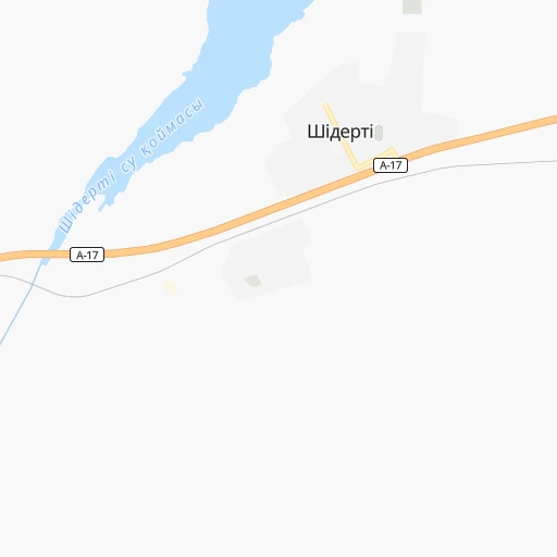

How to get from Stansasy Shiderti (Pavlodar Region) to Bayanaul (Pavlodar Region)
Calculate route from Stansasy Shiderti (Pavlodar Region, Kazakhstan) to Bayanaul (Pavlodar Region, Kazakhstan).
The flight distance (as the crow flies) between Stansasy Shiderti and Bayanaul is 124.5 km.
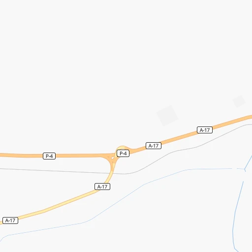
Roadmap (route) to go from Stansasy Shiderti to Bayanaul detailed above, you can also see the course layout on the map.
While doing trip Stansasy Shiderti - Bayanaul by car, the calculated route ends at a distance , or more straight.
Distance and duration of the route between Stansasy Shiderti and Bayanaul
Calculation of distance and route from Bayanaul to Stansasy Shiderti :
124.5183.8 km3h44mn
Continue 0h0mn 131 mTurn left 0h1mn 700 mTurn slight left 0h1mn 580 mTurn right 0h21mn 41.0 kmTurn sharp right 0h9mn 7.5 kmTurn right 0h6mn 5.2 kmTurn left onto улица Султанмахмута Торайгырова 0h1mn 889 mTurn right onto улица Беркимбаева 0h2mn 1.4 kmTurn left onto Короткий проезд 0h1mn 260 mTurn right onto улица Казбека Нуралина 0h1mn 385 mTurn right onto KS-17 0h12mn 11.8 kmTurn right onto KS-17 0h28mn 28.1 kmKeep right 0h1mn 633 mTurn slight right onto P-27 1h15mn 82.1 kmTurn right 0h0mn 228 mKeep left onto К.Сатпаева улица 0h2mn 1.2 kmContinue onto К.Сатпаева улица 0h3mn 1.5 kmTurn right 0h0mn 76 mArrive at destination 0h0mn 0 m
Travel from Stansasy Shiderti (Pavlodar Region) to a selection of major cities.
Distances from Stansasy Shiderti to biggest cities in Pavlodar Region
Other major cities in country :
- Zhanaozen [09], 103,598 inhabitants. 1,874 km
- Turkestan [10], 97,360 inhabitants. 1,052 km
- Balqash [12], 81,364 inhabitants. 541 km
- Sarkand [01], 76,919 inhabitants. 800 km
- Baikonur [08], 70,000 inhabitants. 1,073 km
- Kentau [10], 57,408 inhabitants. 1,021 km
- Ridder [15], 52,664 inhabitants. 637 km
- Qulsary [06], 51,216 inhabitants. 1,582 km
Route from Bayanaul to major cities (Kazakhstan).
- Distance Bayanaul Almaty844 km
- Distance Bayanaul Karagandy215 km
- Distance Bayanaul Shymkent1,054 km
- Distance Bayanaul Taraz938 km
- Distance Bayanaul Astana301 km
- Distance Bayanaul Ust-Kamenogorsk498 km
- Distance Bayanaul Kyzyl-Orda1,008 km
- Distance Bayanaul Kyzylorda1,007 km
- Distance Bayanaul Semey325 km
- Distance Bayanaul Aktobe1,306 km
- Distance Bayanaul Kostanay869 km
- Distance Bayanaul Petropavl632 km
- Distance Bayanaul Oral1,697 km
- Distance Bayanaul Atyrau1,780 km
- Distance Bayanaul Temirtau211 km
- Distance Bayanaul Aktau2,006 km
- Distance Bayanaul Kokshetau513 km
- Distance Bayanaul Rudnyy897 km
- Distance Bayanaul Taldykorgan673 km
- Distance Bayanaul Zhezqazghan666 km
Nearest cities to Stansasy Shiderti :
- Karagandy, 451,800 inhabitants. 239 km
- Pavlodar, 329,002 inhabitants. 170 km
- Temirtau, 170,600 inhabitants. 219 km
- Ekibastuz, 121,470 inhabitants. 46 km
- Stepnogorsk, 46,736 inhabitants. 204 km
- Aksu, 44,808 inhabitants. 160 km
- Soran, 42,552 inhabitants. 249 km
- Shakhtinsk, 41,602 inhabitants. 266 km
- Abay, 35,454 inhabitants. 263 km
- Yermentau, 14,169 inhabitants. 108 km
- Shakhan, 13,273 inhabitants. 253 km
- Aktas, 9,888 inhabitants. 246 km
- Aktau, 9,500 inhabitants. 198 km
- Irtyshsk, 9,216 inhabitants. 189 km
- Qashyr, 8,931 inhabitants. 180 km
- Leninskiy, 8,646 inhabitants. 158 km
- Aksu, 8,543 inhabitants. 203 km
- Qarqaraly, 8,195 inhabitants. 262 km
- Mayqayyng, 7,695 inhabitants. 83 km
- Osakarovka, 7,305 inhabitants. 194 km
- Bestobe, 7,189 inhabitants. 139 km
- Zholymbet, 6,876 inhabitants. 203 km
- Kzyltu, 6,779 inhabitants. 266 km
- Zavodskoy, 6,043 inhabitants. 200 km
- Bayanaul, 5,700 inhabitants. 125 km
- Kalkaman, 5,415 inhabitants. 98 km
- Zhelezinka, 5,225 inhabitants. 209 km
- Novodolinskiy, 5,167 inhabitants. 262 km
- Aksu-Ayuly, 4,721 inhabitants. 335 km
- Dolinka, 4,543 inhabitants. 266 km
- Tokarevka, 4,098 inhabitants. 206 km
- Kushoky, 3,920 inhabitants. 186 km
- Belogor'ye, 3,610 inhabitants. 195 km
- Prigorodnoye, 3,563 inhabitants. 233 km
- Talshik, 3,111 inhabitants. 286 km
Location Stansasy Shiderti (Pavlodar Region) :
| Country flag |  |
| Location | Stansasy Shiderti |
| State | Pavlodar Region |
| County | |
| Country | Kazakhstan |
| Country code / ISO 2 | KZ |
| Latitude | 51.7055700 |
| Longitude | 74.6629100 |
| Altitude | 0 meters |
| Time zone | Asia/Almaty |
Location Bayanaul (Pavlodar Region) :
| Country flag | |
| Location | Bayanaul |
| State | Pavlodar Region |
| County | |
| Country | Kazakhstan |
| Country code / ISO 2 | KZ |
| Latitude | 50.7930400 |
| Longitude | 75.7012300 |
| Altitude | 0 meters |
| Time zone | Asia/Almaty |