


Home
››
Stantsiya Dnipropetrovs’k-Vantazhnyy
››
Roadmap from Stantsiya Dnipropetrovs’k-Vantazhnyy to Nikopol
How to get from Stantsiya Dnipropetrovs’k-Vantazhnyy (Dnipropetrovsk) to Nikopol (Dnipropetrovsk)
Calculate route from Stantsiya Dnipropetrovs’k-Vantazhnyy (Dnipropetrovsk, Ukraine) to Nikopol (Dnipropetrovsk, Ukraine).
The flight distance (as the crow flies) between Stantsiya Dnipropetrovs’k-Vantazhnyy and Nikopol is 104.3 km.
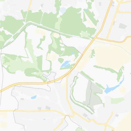
Roadmap (route) to go from Stantsiya Dnipropetrovs’k-Vantazhnyy to Nikopol detailed above, you can also see the course layout on the map.
While doing trip Stantsiya Dnipropetrovs’k-Vantazhnyy - Nikopol by car, the calculated route ends at a distance , or more straight.
Distance and duration of the route between Stantsiya Dnipropetrovs’k-Vantazhnyy and Nikopol
Calculation of distance and route from Nikopol to Stantsiya Dnipropetrovs’k-Vantazhnyy :
104.3117.1 km2h37mn
Continue 0h0mn 28 mTurn left onto вулиця Юності 0h4mn 2.1 kmTurn slight left 0h3mn 2.4 kmTurn sharp right 0h0mn 82 mTurn sharp left onto Миколаївська вулиця 0h2mn 866 mTurn right 0h1mn 332 mTurn left 0h0mn 58 mTurn slight left onto Миколаївська вулиця 0h5mn 4.1 kmTurn right onto Т-04-21 0h1mn 625 mTurn left 0h4mn 5.6 kmKeep right 0h18mn 29.7 kmKeep right and take Р-73 toward Нікополь 0h0mn 409 mContinue onto Р-73 1h51mn 63.1 kmAt roundabout, take exit 1 onto Н-23 0h6mn 6.9 kmTurn right onto вулиця Незалежності України 0h1mn 618 mTurn right onto вулиця Шевченка 0h0mn 111 mTurn right 0h0mn 48 mTurn right 0h0mn 8 mArrive at destination 0h0mn 0 m
Travel from Stantsiya Dnipropetrovs’k-Vantazhnyy (Dnipropetrovsk) to a selection of major cities.
Distances from Stantsiya Dnipropetrovs’k-Vantazhnyy to biggest cities in Dnipropetrovsk
Other major cities in country :
- Horlivka [05], 278,550 inhabitants. 227 km
- Rivne [19], 255,106 inhabitants. 678 km
- Kropyvnytskyi [10], 249,454 inhabitants. 202 km
- Chernivtsi [03], 236,250 inhabitants. 669 km
- Ternopil [22], 235,676 inhabitants. 698 km
- Kremenchuk [18], 227,494 inhabitants. 136 km
- Lutsk [24], 213,661 inhabitants. 743 km
- Ivano-Frankivsk [06], 204,200 inhabitants. 757 km
- Bila Tserkva [13], 199,163 inhabitants. 387 km
- Kramators'k [05], 173,700 inhabitants. 192 km
- Melitopol [26], 158,000 inhabitants. 177 km
- Kerch [11], 148,932 inhabitants. 360 km
- Syevyerodonets'k [14], 130,000 inhabitants. 264 km
- Sloviansk [05], 124,800 inhabitants. 199 km
- Berdyansk [26], 118,284 inhabitants. 229 km
- Uzhgorod [25], 117,878 inhabitants. 935 km
- Alchevs'k [14], 116,000 inhabitants. 283 km
- Lysychans'k [14], 111,600 inhabitants. 259 km
- Yevpatoriya [11], 106,202 inhabitants. 379 km
- Yenakiyeve [05], 104,101 inhabitants. 239 km
Route from Nikopol to major cities (Ukraine).
- Distance Nikopol Kyiv428 km
- Distance Nikopol Kharkiv301 km
- Distance Nikopol Donetsk260 km
- Distance Nikopol Odessa303 km
- Distance Nikopol Zaporizhia66 km
- Distance Nikopol Lviv802 km
- Distance Nikopol Mykolayiv193 km
- Distance Nikopol Mariupol243 km
- Distance Nikopol Luhansk382 km
- Distance Nikopol Sevastopol339 km
- Distance Nikopol Khmelnytskyi583 km
- Distance Nikopol Makiyivka269 km
- Distance Nikopol Vinnytsia475 km
- Distance Nikopol Simferopol292 km
- Distance Nikopol Kherson169 km
- Distance Nikopol Poltava225 km
- Distance Nikopol Chernihiv492 km
- Distance Nikopol Cherkasy269 km
- Distance Nikopol Sumy374 km
- Distance Nikopol Zhytomyr515 km
Nearest cities to Stantsiya Dnipropetrovs’k-Vantazhnyy :
- Kharkiv, 1,430,885 inhabitants. 196 km
- Dnipro, 1,032,822 inhabitants. 6 km
- Donetsk, 1,024,700 inhabitants. 213 km
- Zaporizhia, 796,217 inhabitants. 68 km
- Kryvyi Rih, 652,380 inhabitants. 132 km
- Mykolayiv, 510,840 inhabitants. 277 km
- Mariupol, 481,626 inhabitants. 241 km
- Makiyivka, 376,610 inhabitants. 222 km
- Kherson, 320,477 inhabitants. 265 km
- Poltava, 317,847 inhabitants. 135 km
- Cherkasy, 297,568 inhabitants. 242 km
- Sumy, 294,456 inhabitants. 279 km
- Kropyvnytskyi, 249,454 inhabitants. 202 km
- Kamianske, 248,575 inhabitants. 30 km
- Kremenchuk, 227,494 inhabitants. 136 km
- Kramators'k, 173,700 inhabitants. 192 km
- Melitopol, 158,000 inhabitants. 177 km
- Nikopol, 130,500 inhabitants. 104 km
- Sloviansk, 124,800 inhabitants. 199 km
- Berdyansk, 118,284 inhabitants. 229 km
- Pavlohrad, 115,932 inhabitants. 66 km
- Oleksandriya, 103,000 inhabitants. 141 km
- Konotop, 91,798 inhabitants. 339 km
- Kostyantynivka, 91,259 inhabitants. 201 km
- Novomoskovs'k, 73,100 inhabitants. 31 km
- Pokrovsk, 68,263 inhabitants. 162 km
- Pryluky, 62,823 inhabitants. 306 km
- Druzhkivka, 62,315 inhabitants. 190 km
- Lozova, 62,311 inhabitants. 111 km
- Energodar, 55,800 inhabitants. 106 km
- Izyum, 53,778 inhabitants. 187 km
- Lubny, 52,600 inhabitants. 229 km
- Horishni Plavni, 51,740 inhabitants. 119 km
- Zhovti Vody, 51,559 inhabitants. 110 km
- Nova Kakhovka, 50,672 inhabitants. 223 km
- Marhanets', 50,443 inhabitants. 92 km
- Okhtyrka, 49,818 inhabitants. 210 km
- Myrnohrad, 49,646 inhabitants. 168 km
- Romny, 48,570 inhabitants. 281 km
- Svitlovods'k, 47,946 inhabitants. 146 km
- Toretsk, 41,758 inhabitants. 211 km
- Dzhankoy, 41,731 inhabitants. 305 km
- Myrhorod, 41,377 inhabitants. 199 km
- Yasynuvata, 37,600 inhabitants. 215 km
- Kakhovka, 36,816 inhabitants. 212 km
- Chuhuyiv, 36,519 inhabitants. 200 km
- Dobropillya, 35,977 inhabitants. 155 km
- Avdiyivka, 35,826 inhabitants. 206 km
- Tokmak, 34,926 inhabitants. 141 km
- Dolyns'ka, 34,267 inhabitants. 169 km
Location Stantsiya Dnipropetrovs’k-Vantazhnyy (Dnipropetrovsk) :
| Country flag |  |
| Location | Stantsiya Dnipropetrovs’k-Vantazhnyy |
| State | Dnipropetrovsk |
| County | |
| Country | Ukraine |
| Country code / ISO 2 | UA |
| Latitude | 48.4214500 |
| Longitude | 34.9899900 |
| Altitude | 0 meters |
| Time zone | Europe/Kiev |
Location Nikopol (Dnipropetrovsk) :
| Country flag | |
| Location | Nikopol |
| State | Dnipropetrovsk |
| County | |
| Country | Ukraine |
| Country code / ISO 2 | UA |
| Latitude | 47.5711900 |
| Longitude | 34.3963700 |
| Altitude | 0 meters |
| Time zone | Europe/Kiev |
