
How to get from Ahmednagar Railway Station (Maharashtra) to Gulbarga (Karnataka)
Calculate route from Ahmednagar Railway Station (Maharashtra, India) to Gulbarga (Karnataka, India).
The flight distance (as the crow flies) between Ahmednagar Railway Station and Gulbarga is 295.4 km.
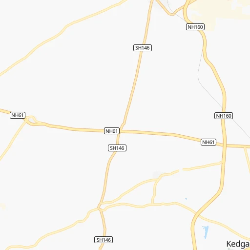
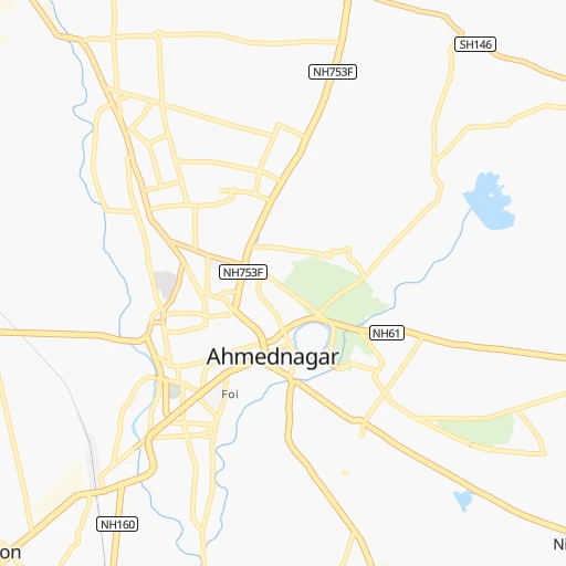
Roadmap (route) to go from Ahmednagar Railway Station to Gulbarga detailed above, you can also see the course layout on the map.
While doing trip Ahmednagar Railway Station - Gulbarga by car, the calculated route ends at a distance , or more straight.
Distance and duration of the route between Ahmednagar Railway Station and Gulbarga
Calculation of distance and route from Gulbarga to Ahmednagar Railway Station :
295.4339.2 km5h6mn
Continue 0h0mn 102 mContinue onto Station Road 0h1mn 1.0 kmKeep right 0h0mn 29 mTurn sharp right 0h0mn 17 mTurn sharp left onto Kothi Yash Palace Road 0h1mn 1.2 kmTurn right onto Sarasnagar Road 0h0mn 174 mKeep left onto Sarasnagar Road 0h0mn 163 mKeep left 0h1mn 386 mTurn left 0h1mn 280 mTurn sharp right onto Sarasnagar Road 0h1mn 533 mTurn slight right onto Solapur Dhule National Highway 1h19mn 91.9 kmTurn left onto NH561A 0h1mn 1.6 kmTurn left onto SH67 1h40mn 43.7 kmTurn left 0h1mn 602 mKeep right 0h0mn 35 mTurn slight right onto Kurduvadi Bypass 0h2mn 2.0 kmTurn sharp left 0h0mn 361 mTurn slight right onto SH149 0h9mn 9.8 kmKeep right 0h2mn 1.7 kmTurn sharp left onto MDR16 0h1mn 643 mTurn sharp right onto SH149 0h22mn 23.8 kmTurn left onto Pune Sholapur Road 1h31mn 36.6 kmKeep left 0h0mn 197 mTurn right 0h0mn 97 mKeep left 0h0mn 55 mKeep left 0h1mn 805 mAt roundabout, take exit 2 onto Panjarpol Chowk 0h0mn 245 mTurn left 0h1mn 644 mTurn right 0h0mn 69 mTurn left onto Hanuman Garden Prabhat Teater Road 0h0mn 310 mTurn left 0h0mn 216 mTurn slight right onto Budhwar Bazaar Road 0h21mn 23.8 kmKeep left onto NH150 0h13mn 15.6 kmKeep left 0h8mn 9.7 kmTurn slight right 0h1mn 599 mTurn left 0h2mn 1.7 kmKeep right 0h8mn 6.7 kmContinue onto SH124 0h2mn 2.0 kmTurn right onto SH124 0h0mn 208 mKeep left onto SH162 0h12mn 13.2 kmTurn right onto SH162 0h2mn 2.1 kmTurn left onto SH34 0h0mn 233 mTurn right 0h1mn 616 mTurn right 0h0mn 206 mTurn slight left 0h1mn 256 mTurn slight right 0h0mn 241 mTurn sharp right onto SH162 0h12mn 13.0 kmTurn sharp right onto SH10 0h23mn 25.8 kmTurn left onto Ring Road 0h0mn 2 mKeep right onto Ring Road 0h0mn 11 mTurn left onto Alanda Road 0h2mn 2.0 kmAt roundabout, take exit 2 onto Alanda Road 0h1mn 1.0 kmAt roundabout, take exit 3 0h1mn 673 mTurn left 0h0mn 82 mArrive at destination 0h0mn 0 m
Travel from Ahmednagar Railway Station (Karnataka) to a selection of major cities.
Distances from Ahmednagar Railway Station to biggest cities in Maharashtra
- Malegaon,435,362 inhabitants.165 km
- Jalgaon,429,298 inhabitants.232 km
- Akola,428,857 inhabitants.300 km
- Ahmadnagar,367,140 inhabitants.3 km
- Dhulia,366,980 inhabitants.203 km
- Latur,348,967 inhabitants.209 km
- Chanda,328,351 inhabitants.490 km
- Parbhani,289,629 inhabitants.217 km
- Ichalkaranji,274,383 inhabitants.267 km
- Jalna,262,034 inhabitants.149 km
- Amarnath,217,780 inhabitants.164 km
- Bhusaval,183,001 inhabitants.246 km
- Virar,150,357 inhabitants.205 km
- Yavatmal,128,175 inhabitants.386 km
- Panvel,128,046 inhabitants.170 km
- Gondia,124,897 inhabitants.630 km
- Wardha,113,759 inhabitants.446 km
- Satara,112,793 inhabitants.173 km
- Achalpur,111,278 inhabitants.379 km
- Barsi,110,983 inhabitants.139 km
Other major cities in country :
- Faridabad [10], 1,220,229 inhabitants. 1,072 km
- Ghaziabad [36], 1,199,191 inhabitants. 1,103 km
- Rajkot [09], 1,177,362 inhabitants. 544 km
- Varanasi [36], 1,164,404 inhabitants. 1,101 km
- Amritsar [23], 1,092,450 inhabitants. 1,397 km
- Allahabad [36], 1,073,438 inhabitants. 1,020 km
- Visakhapatnam [02], 1,063,178 inhabitants. 909 km
- Teni [25], 1,034,724 inhabitants. 1,052 km
- Jabalpur [35], 1,030,168 inhabitants. 709 km
- Haora [28], 1,027,672 inhabitants. 1,467 km
- Srinagar [12], 975,857 inhabitants. 1,671 km
- Chandigarh [05], 960,787 inhabitants. 1,315 km
- Coimbatore [25], 959,823 inhabitants. 930 km
- Jodhpur [24], 921,476 inhabitants. 820 km
- Madurai [25], 909,908 inhabitants. 1,083 km
- Guwahati [03], 899,094 inhabitants. 1,917 km
- Gwalior [35], 882,458 inhabitants. 872 km
- Vijayawada [02], 874,587 inhabitants. 690 km
- Mysore [19], 868,313 inhabitants. 782 km
- Ranchi [38], 846,454 inhabitants. 1,197 km
Route from Gulbarga to major cities (India).
- Distance Gulbarga Mumbai461 km
- Distance Gulbarga Delhi1,260 km
- Distance Gulbarga Kolkata1,338 km
- Distance Gulbarga Chennai600 km
- Distance Gulbarga Ahmedabad773 km
- Distance Gulbarga Hyderabad172 km
- Distance Gulbarga Pune342 km
- Distance Gulbarga Surat602 km
- Distance Gulbarga Kanpur1,079 km
- Distance Gulbarga Jaipur1,072 km
- Distance Gulbarga Navi Mumbai446 km
- Distance Gulbarga Lucknow1,138 km
- Distance Gulbarga Nagpur485 km
- Distance Gulbarga Indore608 km
- Distance Gulbarga Patna1,258 km
- Distance Gulbarga Bhopal662 km
- Distance Gulbarga Ludhiana1,515 km
- Distance Gulbarga Tirunelveli963 km
- Distance Gulbarga Agra1,103 km
- Distance Gulbarga Vadodara671 km
Nearest cities to Ahmednagar Railway Station :
- Mumbai, 12,691,836 inhabitants. 193 km
- Pune, 2,935,744 inhabitants. 110 km
- Surat, 2,894,504 inhabitants. 308 km
- Navi Mumbai, 2,600,000 inhabitants. 180 km
- Nashik, 1,289,497 inhabitants. 142 km
- Pimpri, 1,284,606 inhabitants. 109 km
- Kalyan, 1,262,255 inhabitants. 168 km
- Thane, 1,261,517 inhabitants. 185 km
- Dombivli, 1,193,000 inhabitants. 173 km
- Aurangabad, 1,016,441 inhabitants. 111 km
- Shivaji Nagar, 1,000,000 inhabitants. 110 km
- Solapur, 997,281 inhabitants. 200 km
- Bhiwandi, 707,035 inhabitants. 177 km
- Borivli, 609,617 inhabitants. 197 km
- Sangli, 601,214 inhabitants. 248 km
- Bhavnagar, 554,978 inhabitants. 402 km
- Nanded, 550,564 inhabitants. 273 km
- Bhayandar, 520,301 inhabitants. 198 km
- Ulhasnagar, 516,584 inhabitants. 166 km
- Kolhapur, 516,142 inhabitants. 270 km
- Bilimora, 510,879 inhabitants. 264 km
- Gulbarga, 483,615 inhabitants. 296 km
- Malegaon, 435,362 inhabitants. 165 km
- Jalgaon, 429,298 inhabitants. 232 km
- Akola, 428,857 inhabitants. 300 km
- Ahmadnagar, 367,140 inhabitants. 3 km
- Dhulia, 366,980 inhabitants. 203 km
- Latur, 348,967 inhabitants. 209 km
- Parbhani, 289,629 inhabitants. 217 km
- Ichalkaranji, 274,383 inhabitants. 267 km
- Bijapur, 271,064 inhabitants. 272 km
- Jalna, 262,034 inhabitants. 149 km
- Raichur, 225,962 inhabitants. 424 km
- Amarnath, 217,780 inhabitants. 164 km
- Bidar, 204,071 inhabitants. 323 km
- Burhanpur, 202,695 inhabitants. 294 km
- Bhusaval, 183,001 inhabitants. 246 km
- Khandwa, 182,841 inhabitants. 350 km
- Bharuch, 153,528 inhabitants. 344 km
- Virar, 150,357 inhabitants. 205 km
- Panvel, 128,046 inhabitants. 170 km
- Satara, 112,793 inhabitants. 173 km
- Achalpur, 111,278 inhabitants. 379 km
- Barsi, 110,983 inhabitants. 139 km
- Badlapur, 104,636 inhabitants. 153 km
- Udgir, 101,064 inhabitants. 264 km
- Nandurbar, 100,703 inhabitants. 260 km
- Airoli, 100,000 inhabitants. 182 km
- Amalner, 97,369 inhabitants. 222 km
- Bagalkot, 97,269 inhabitants. 338 km
Location Ahmednagar Railway Station (Maharashtra) :
| Country flag |  |
| Location | Ahmednagar Railway Station |
| State | Maharashtra |
| County | Ahmadnagar |
| Country | India |
| Country code / ISO 2 | IN |
| Latitude | 19.0754200 |
| Longitude | 74.7215400 |
| Altitude | 0 meters |
| Time zone | Asia/Kolkata |
Location Gulbarga (Karnataka) :
| Country flag | |
| Location | Gulbarga |
| State | Karnataka |
| County | Gulbarga |
| Country | India |
| Country code / ISO 2 | IN |
| Latitude | 17.3358300 |
| Longitude | 76.8375700 |
| Altitude | 0 meters |
| Time zone | Asia/Kolkata |


