
How to get from Yongan-yŏk (Jeollabuk-do) to Kimje (Jeollabuk-do)
Calculate route from Yongan-yŏk (Jeollabuk-do, South Korea) to Kimje (Jeollabuk-do, South Korea).
The flight distance (as the crow flies) between Yongan-yŏk and Kimje is 35.2 km.
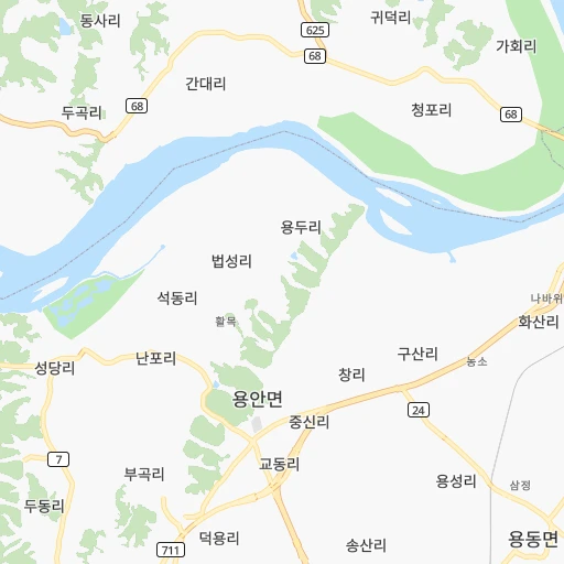
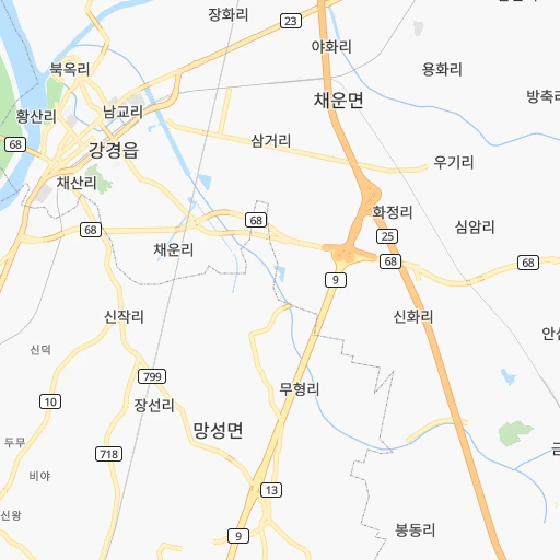
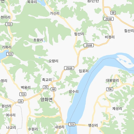
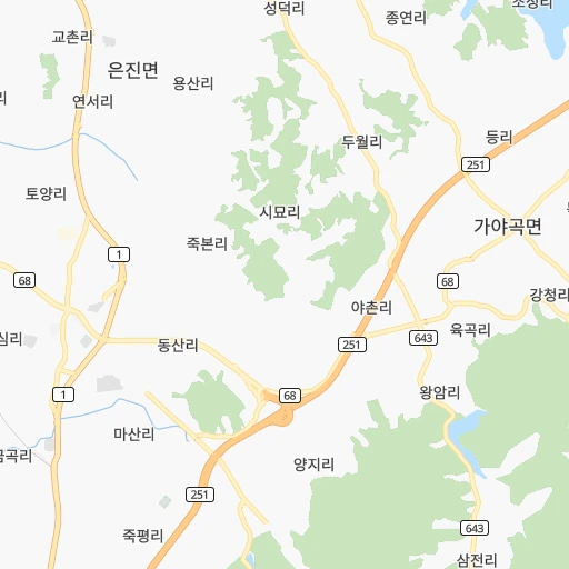
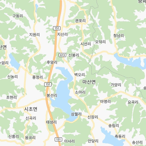
Roadmap (route) to go from Yongan-yŏk to Kimje detailed above, you can also see the course layout on the map.
While doing trip Yongan-yŏk - Kimje by car, the calculated route ends at a distance , or more straight.
Distance and duration of the route between Yongan-yŏk and Kimje
Calculation of distance and route from Kimje to Yongan-yŏk :
35.240.0 km1h39mn
Continue onto 용동1길 0h0mn 70 mKeep left onto 용동1길 0h1mn 463 mTurn right onto 안성로 0h3mn 2.7 kmContinue onto 안성로 0h1mn 459 mTurn right onto 안성로 0h0mn 13 mTurn left onto 익산대로 0h5mn 5.5 kmContinue onto 익산대로 0h9mn 9.2 kmKeep right 0h14mn 16.5 kmContinue onto 하공로 0h5mn 4.3 kmAt roundabout, take exit 4 onto 중앙로 0h1mn 551 mTurn right onto 요촌7길 0h0mn 46 mKeep left onto 요촌7길 0h0mn 20 mTurn left onto 요촌8길 0h0mn 70 mTurn right onto 요촌8길 0h0mn 89 mArrive at destination 0h0mn 0 m
Travel from Yongan-yŏk (Jeollabuk-do) to a selection of major cities.
Distances from Yongan-yŏk to biggest cities in Jeollabuk-do
Other major cities in country :
- Cheonan [17], 365,114 inhabitants. 79 km
- Kwangmyong [13], 357,545 inhabitants. 153 km
- Kimhae [20], 356,242 inhabitants. 197 km
- Chinju [20], 307,242 inhabitants. 142 km
- Yeosu [16], 295,538 inhabitants. 162 km
- Gumi [14], 291,006 inhabitants. 121 km
- Mokpo [16], 268,402 inhabitants. 154 km
- Wonju [06], 243,387 inhabitants. 163 km
- Suncheon [16], 230,796 inhabitants. 136 km
- Sejong [22], 230,327 inhabitants. 60 km
- Chuncheon [06], 209,746 inhabitants. 207 km
- Icheon-si [13], 196,230 inhabitants. 136 km
- Guri-si [13], 195,236 inhabitants. 166 km
- Gangneung [06], 180,611 inhabitants. 248 km
- Yangju [13], 179,923 inhabitants. 192 km
- Osan [13], 158,978 inhabitants. 116 km
- Seogwipo [01], 155,691 inhabitants. 320 km
- Gyeongju [14], 155,237 inhabitants. 202 km
- Gimcheon [14], 150,000 inhabitants. 102 km
- Hanam [13], 134,902 inhabitants. 161 km
Route from Kimje to major cities (South Korea).
- Distance Kimje Seoul197 km
- Distance Kimje Busan210 km
- Distance Kimje Incheon185 km
- Distance Kimje Daegu154 km
- Distance Kimje Daejeon75 km
- Distance Kimje Gwangju72 km
- Distance Kimje Suwon166 km
- Distance Kimje Goyang-si207 km
- Distance Kimje Seongnam-si184 km
- Distance Kimje Ulsan222 km
- Distance Kimje Bucheon-si189 km
- Distance Kimje Ansan-si170 km
- Distance Kimje Cheongju-si108 km
- Distance Kimje Anyang-si177 km
- Distance Kimje Changwon174 km
- Distance Kimje Pohang225 km
- Distance Kimje Uijeongbu-si216 km
- Distance Kimje Hwaseong-si157 km
- Distance Kimje Masan75 km
- Distance Kimje Jeju City257 km
Nearest cities to Yongan-yŏk :
- Seoul, 10,349,312 inhabitants. 162 km
- Busan, 3,678,555 inhabitants. 217 km
- Incheon, 2,628,000 inhabitants. 152 km
- Daegu, 2,566,540 inhabitants. 147 km
- Daejeon, 1,475,221 inhabitants. 45 km
- Gwangju, 1,416,938 inhabitants. 106 km
- Suwon, 1,242,724 inhabitants. 132 km
- Goyang-si, 1,073,069 inhabitants. 173 km
- Seongnam-si, 1,031,935 inhabitants. 149 km
- Ulsan, 962,865 inhabitants. 219 km
- Bucheon-si, 850,731 inhabitants. 156 km
- Jeonju, 711,424 inhabitants. 35 km
- Ansan-si, 650,728 inhabitants. 136 km
- Cheongju-si, 634,596 inhabitants. 74 km
- Anyang-si, 634,367 inhabitants. 143 km
- Changwon, 550,000 inhabitants. 182 km
- Pohang, 500,000 inhabitants. 214 km
- Uijeongbu-si, 479,141 inhabitants. 182 km
- Hwaseong-si, 476,297 inhabitants. 123 km
- Masan, 434,371 inhabitants. 110 km
- Jeju City, 408,364 inhabitants. 292 km
- Cheonan, 365,114 inhabitants. 79 km
- Kwangmyong, 357,545 inhabitants. 153 km
- Kimhae, 356,242 inhabitants. 197 km
- Chinju, 307,242 inhabitants. 142 km
- Yeosu, 295,538 inhabitants. 162 km
- Gumi, 291,006 inhabitants. 121 km
- Iksan, 283,501 inhabitants. 19 km
- Mokpo, 268,402 inhabitants. 154 km
- Gunsan, 243,406 inhabitants. 29 km
- Wonju, 243,387 inhabitants. 163 km
- Suncheon, 230,796 inhabitants. 136 km
- Sejong, 230,327 inhabitants. 60 km
- Chuncheon, 209,746 inhabitants. 207 km
- Icheon-si, 196,230 inhabitants. 136 km
- Guri-si, 195,236 inhabitants. 166 km
- Gangneung, 180,611 inhabitants. 248 km
- Yangju, 179,923 inhabitants. 192 km
- Osan, 158,978 inhabitants. 116 km
- Seogwipo, 155,691 inhabitants. 320 km
- Gyeongju, 155,237 inhabitants. 202 km
- Gimcheon, 150,000 inhabitants. 102 km
- Jeongeup, 139,876 inhabitants. 57 km
- Hanam, 134,902 inhabitants. 161 km
- Gyeongsan-si, 129,903 inhabitants. 161 km
- Andong, 129,319 inhabitants. 163 km
- Hwado, 106,358 inhabitants. 174 km
- Tonghae, 101,128 inhabitants. 247 km
- Asan, 97,749 inhabitants. 75 km
- Wabu, 96,775 inhabitants. 166 km
Location Yongan-yŏk (Jeollabuk-do) :
| Country flag |  |
| Location | Yongan-yŏk |
| State | Jeollabuk-do |
| County | |
| Country | South Korea |
| Country code / ISO 2 | KR |
| Latitude | 36.1077800 |
| Longitude | 126.9911100 |
| Altitude | 0 meters |
| Time zone | Asia/Seoul |
Location Kimje (Jeollabuk-do) :
| Country flag | |
| Location | Kimje |
| State | Jeollabuk-do |
| County | |
| Country | South Korea |
| Country code / ISO 2 | KR |
| Latitude | 35.8016700 |
| Longitude | 126.8888900 |
| Altitude | 0 meters |
| Time zone | Asia/Seoul |