
How to get from Maḩaţţat Thulayjīnah (Aleppo) to Al Ḩasakah (Al-Hasakah)
Calculate route from Maḩaţţat Thulayjīnah (Aleppo, Syria) to Al Ḩasakah (Al-Hasakah, Syria).
The flight distance (as the crow flies) between Maḩaţţat Thulayjīnah and Al Ḩasakah is 340.6 km.
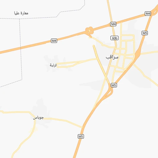
Roadmap (route) to go from Maḩaţţat Thulayjīnah to Al Ḩasakah detailed above, you can also see the course layout on the map.
While doing trip Maḩaţţat Thulayjīnah - Al Ḩasakah by car, the calculated route ends at a distance , or more straight.
Distance and duration of the route between Maḩaţţat Thulayjīnah and Al Ḩasakah
Calculation of distance and route from Al Ḩasakah to Maḩaţţat Thulayjīnah :
340.6410.0 km6h3mn
Continue 0h2mn 620 mTurn right 0h0mn 249 mTurn slight left 0h24mn 23.8 kmTurn left 0h18mn 20.0 kmTurn right 0h1mn 645 mKeep left 0h0mn 265 mTurn right onto شارع جعفر الصادق 0h1mn 1.5 kmAt roundabout, take exit 2 onto Hawl al Balda Street 0h1mn 678 mAt roundabout, take exit 2 onto شارع الراشدين 0h1mn 782 mKeep right onto شارع الراشدين 0h0mn 41 mTurn right 0h0mn 79 mTurn left 0h1mn 484 mKeep right 0h1mn 682 mAt roundabout, take exit 2 onto دوار الحلوانية 0h1mn 1.1 kmTurn left onto 212 0h26mn 28.4 kmTurn sharp right 0h0mn 217 mTurn left onto M4 0h5mn 6.1 kmAt roundabout, take exit 3 onto M4 1h38mn 44.0 kmAt roundabout, take exit 2 onto دوار المطاحن 0h30mn 34.4 kmAt roundabout, take exit 2 onto طريق سوريا 0h27mn 31.1 kmAt roundabout, take exit 1 onto طريق سوريا 2h28mn 173.1 kmAt roundabout, take exit 1 onto 716 1h33mn 36.7 kmAt roundabout, take exit 2 0h2mn 2.1 kmTurn left 0h1mn 579 mAt roundabout, take exit 2 onto 7 0h1mn 1.0 kmAt roundabout, take exit 2 onto 7 0h0mn 451 mKeep right 0h0mn 269 mAt roundabout, take exit 3 0h1mn 610 mTurn right 0h0mn 32 mArrive at destination 0h0mn 0 m
Travel from Maḩaţţat Thulayjīnah (Al-Hasakah) to a selection of major cities.
Distances from Maḩaţţat Thulayjīnah to biggest cities in Aleppo
Other major cities in country :
Route from Al Ḩasakah to major cities (Syria).
- Distance Al Ḩasakah Aleppo323 km
- Distance Al Ḩasakah Damascus525 km
- Distance Al Ḩasakah Homs414 km
- Distance Al Ḩasakah Hamah391 km
- Distance Al Ḩasakah Latakia459 km
- Distance Al Ḩasakah Deir ez-Zor141 km
- Distance Al Ḩasakah Ar Raqqah168 km
- Distance Al Ḩasakah Al Bab290 km
- Distance Al Ḩasakah Idlib375 km
- Distance Al Ḩasakah Douma513 km
- Distance Al Ḩasakah Dar'a607 km
- Distance Al Ḩasakah As Safirah307 km
- Distance Al Ḩasakah As Salamiyah373 km
- Distance Al Ḩasakah Tartouss475 km
- Distance Al Ḩasakah Ath Thawrah211 km
- Distance Al Ḩasakah Darayya533 km
- Distance Al Ḩasakah Manbij250 km
- Distance Al Ḩasakah I`zaz331 km
- Distance Al Ḩasakah Jablah453 km
- Distance Al Ḩasakah As Suwayda'570 km
Nearest cities to Maḩaţţat Thulayjīnah :
- Aleppo, 1,602,264 inhabitants. 41 km
- Damascus, 1,569,394 inhabitants. 269 km
- Homs, 775,404 inhabitants. 128 km
- Hamah, 460,602 inhabitants. 83 km
- Latakia, 340,181 inhabitants. 118 km
- Ar Raqqah, 177,636 inhabitants. 178 km
- Al Bab, 130,745 inhabitants. 72 km
- Idlib, 128,840 inhabitants. 38 km
- Douma, 111,864 inhabitants. 260 km
- As Safirah, 95,832 inhabitants. 40 km
- As Salamiyah, 94,887 inhabitants. 93 km
- Tartouss, 89,457 inhabitants. 149 km
- Ath Thawrah, 87,880 inhabitants. 136 km
- Darayya, 71,596 inhabitants. 276 km
- Manbij, 68,888 inhabitants. 112 km
- I`zaz, 66,138 inhabitants. 82 km
- Jablah, 65,915 inhabitants. 114 km
- At Tall, 55,561 inhabitants. 258 km
- Ar Rastan, 53,152 inhabitants. 106 km
- Tadmur, 51,015 inhabitants. 182 km
- 'Ayn al 'Arab, 50,000 inhabitants. 166 km
- An Nabk, 49,372 inhabitants. 205 km
- Khan Shaykhun, 48,975 inhabitants. 57 km
- `Afrin, 48,693 inhabitants. 76 km
- Kafranbel, 45,652 inhabitants. 50 km
- `Irbin, 42,474 inhabitants. 264 km
- Al Qusayr, 41,062 inhabitants. 155 km
- Yabrud, 40,502 inhabitants. 212 km
- Jisr ash Shughur, 39,311 inhabitants. 65 km
- Baniyas, 39,066 inhabitants. 123 km
- Tallbisah, 38,491 inhabitants. 115 km
- Harasta, 37,348 inhabitants. 262 km
- Al Qunaytirah, 36,143 inhabitants. 323 km
- Tadif, 34,670 inhabitants. 71 km
- Saraqib, 34,231 inhabitants. 21 km
- Jayrud, 32,352 inhabitants. 229 km
- Masyaf, 32,262 inhabitants. 107 km
- Ma`arratmisrin, 32,163 inhabitants. 38 km
- Al Qaryatayn, 31,748 inhabitants. 181 km
- Salqin, 31,608 inhabitants. 62 km
- Souran, 30,716 inhabitants. 67 km
- Binnish, 30,354 inhabitants. 32 km
- Jasim, 30,283 inhabitants. 330 km
- Tallkalakh, 29,754 inhabitants. 149 km
- Az Zabadani, 29,549 inhabitants. 251 km
- Tayyibat al Imam, 29,259 inhabitants. 71 km
- Inkhil, 29,076 inhabitants. 326 km
- Dayr Hafir, 28,905 inhabitants. 70 km
- Satita, 27,815 inhabitants. 141 km
- As Sanamayn, 25,702 inhabitants. 319 km
Location Maḩaţţat Thulayjīnah (Aleppo) :
| Country flag |  |
| Location | Maḩaţţat Thulayjīnah |
| State | Aleppo |
| County | |
| Country | Syria |
| Country code / ISO 2 | SY |
| Latitude | 35.8458000 |
| Longitude | 37.0385100 |
| Altitude | 0 meters |
| Time zone | Asia/Damascus |
Location Al Ḩasakah (Al-Hasakah) :
| Country flag | |
| Location | Al Ḩasakah |
| State | Al-Hasakah |
| County | |
| Country | Syria |
| Country code / ISO 2 | SY |
| Latitude | 36.5023700 |
| Longitude | 40.7477200 |
| Altitude | 0 meters |
| Time zone | Asia/Damascus |